Milos has roughly 70 beaches, scattered around every side of a small, awkwardly shaped island in Greece's western Cyclades. That geography is the whole point: whichever way the wind blows, some stretch of coast is sheltered. This guide covers the best beaches in Milos coast by coast, with how you actually reach each one and which wind ruins it.
In this guide
- Island shape: Horseshoe around a large central gulf that opens to the north
- Port: Adamas, roughly central
- Access types: Asphalt, dirt track, 4WD only, boat, rope descent
- Facilities: Rare. Most beaches have nothing
- Wind rule: A meltemi from the north empties the north coast, so go south; southerlies flip it.
I co-wrote a guidebook to Milos and Kimolos and have gone back repeatedly, in June and in late September. Locals quote a figure of over 70 beaches, and it is true if you count named indentations. Read it as 70 places worth your day and it becomes marketing arithmetic. Perhaps fifteen justify the drive, and several of the famous ones have no shade, no water and no canteen, which people tend to discover at 14:00 with hours of sun left.
Access is the real filter, not beauty. Beaches here sort into four tiers: asphalt, decent dirt track, 4WD or long walk, and boat only. Your vehicle therefore decides your list before your taste does. Read the getting around Milos guide before booking anything with wheels.
Why Does the Wind Decide Where You Swim on Milos?
This is the most useful thing to learn about the island, and it takes a paragraph.
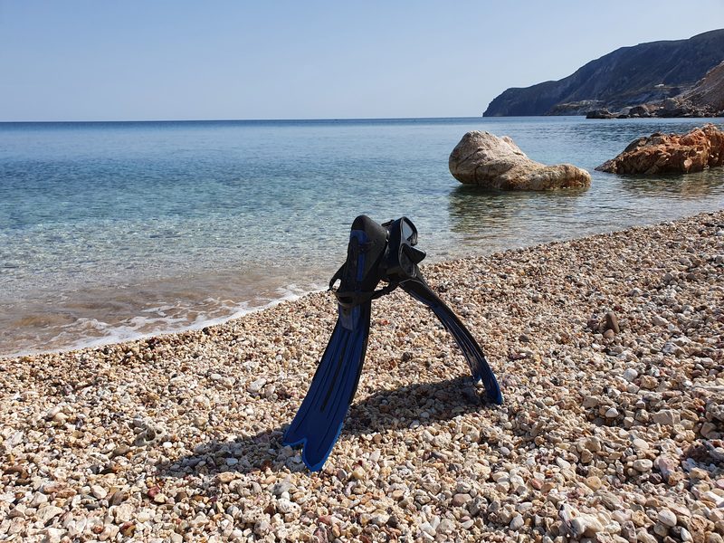
The dominant summer wind in the Aegean is the meltemi, out of the north. When it runs, the north coast is unswimmable: chop, spray, sand in everything, and at enclosed spots like Papafragas, rubbish pushed into the water. On those days you drive south, where Paleochori, Firiplaka, Provatas and Agia Kyriaki can be flat calm.
When the wind swings round from the south, which happens more often than the meltemi story suggests, reverse the rule. The southern beaches take the swell, while the northern bays of Firopotamos, Plathiena, Mandrakia and Pollonia go glassy.
Two caveats from doing this repeatedly. Some days the wind arrives from every direction at once, and those are museum days or long-lunch days. And it usually builds through the afternoon, so a north-coast morning is often still worth having on a meltemi forecast.
Every entry below states its exposure and where to go instead when the wind is wrong.
How Are the Beaches Laid Out? A Text Map of Milos
Milos is a horseshoe whose mouth opens to the north, and the port of Adamas sits deep inside the gulf it encloses. From Adamas the north coast is a short drive and the south coast is under half an hour by quad or car, but the western arm is another world: dirt tracks, no fuel, no shops. Here is the island in five blocks, clockwise from the port, which is the order the sections below follow.
- The inner bay (Adamas and around). Lagada, Papikinou, Achivadolimni, Kanava. Sheltered, sandy, shallow, close to everything, least dramatic.
- The north coast (Adamas to Pollonia). Plathiena, Fourkovouni, Firopotamos, Mandrakia, Sarakiniko, Mytakas, Agios Konstantinos, Alogomandra, Pahena, Papafragas, Pollonia. White rock and fishing hamlets on asphalt, blown out by the meltemi.
- The east coast (below Pollonia). Voudia, Kastanas, Tria Pigadia, Kolibisionas, Thiorichia. Remote, pebbly, dirt roads, and the sun leaves early.
- The south coast (Paleochori round to Kipos). Paleochori, Psaravolada, Agia Kyriaki, Gerakas, Tsigrado, Firiplaka, Provatas, Agios Sostis, Kipos. Volcanic colour, the best all-day beaches, your meltemi bolt-hole.
- The western arm (beyond Kipos). Gerontas, Katergo, Kleftiko, Sikia, Agios Ioannis, Triades, Ammoudaraki, Agathia, Vani, Embourios, Rivari. Boat country.
With three days, everything you need is in blocks two and four plus one boat trip into block five.
Which Are the Best Beaches in Milos? My Shortlist
Ten that earn a place in a plan. Not ranked, and deliberately mixing easy with difficult, because the wind makes the choice for you anyway.
- Sarakiniko (north) is about the white rock landscape, not the sand, of which there is barely any.
- Firopotamos (north) has a sheltered shallow bay, sirmata houses and sea caves worth a mask.
- Agia Kyriaki (south) gives you sand, real shade, tavernas and calm water, and is rarely crammed.
- Firiplaka (south) is long sand under banded volcanic cliffs, with an actual beach bar.
- Agios Ioannis (west) has three long, empty beaches below the monastery, with the sunset to yourself.
- Achivadolimni (inner bay) is the longest beach on Milos and usually the emptiest.
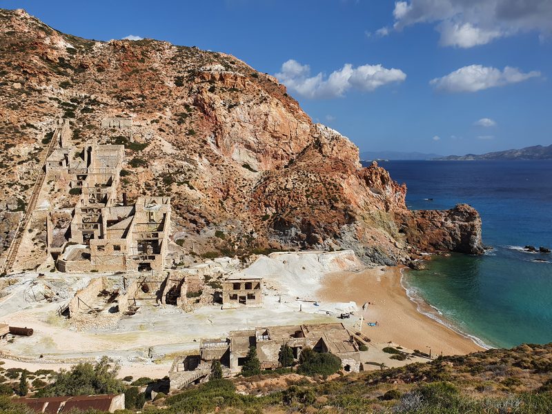
- Thiorichia (east) has abandoned sulphur mines above a yellow beach.
- Kastanas (east) offers coloured pebbles, tiny coves and almost nobody.
- Gerontas (west) has arches and clear water, worth it even when you cannot swim.
- Kleftiko (west) is the white sea stacks, and the image that sells the island.
With one day and settled weather, I would take Firopotamos in the morning and Agia Kyriaki in the afternoon, and save Sarakiniko for the evening light.
What Are the Beaches Around Adamas and the Inner Bay?
Lagada is the town beach: a strip of sand in front of a large hotel, a few trees doing the work an umbrella would otherwise do, and fishing boats moored offshore. Better to look at than swim from, but useful for the hour before a ferry.
Papikinou is a long, narrow band of sand east of the port with loungers, shade trees and watersports, facing the sunset across the bay. Shallow water and a short walk from town make it the most practical choice with small children. Wind exposure: Sheltered inside the bay, so it stays usable when both coasts are being battered.
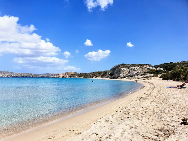
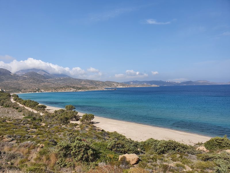
Achivadolimni is about 1.5 km long, the longest beach on Milos, reached on a paved road with several places to pull off. The water stays shallow a long way out and there are enough trees to sit under if you arrive early, but no loungers and nothing to buy, and the right-hand end is set aside for nudists, with a few more spread along the rest of the sand. Wind exposure: It sits on the southern shore of the gulf and faces roughly north, so a meltemi blows down the bay onto it, though the enclosed water keeps the seas smaller than on the open north coast; a southerly should leave it flat.
Kanava is where fumaroles warm the sand, and also where the island's power station sits at one end of an otherwise long beach. Twenty minutes of interest, not a day.
What Are the Best Beaches on the North Coast?
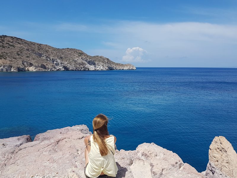
White rock and fishing hamlets, almost all reachable in a normal hire car, and all of it a meltemi casualty.
Plathiena is a sandy bay on the asphalt road down from Plaka, snug in settled weather, with a small canteen and a few umbrellas on both my visits and nothing else nearby, and it is still running as of 2026. Wind exposure: North-facing, and it shuts down in a meltemi, so go to Firiplaka. Detail in the Plathiena beach guide.
Fourkovouni sits along the same road, with the same white sirmata boathouses and no canteen. Nerodafni, further north near a mining area, is rough pebbles down broken dirt roads a regular car should not attempt. Both are north-facing and pointless on a windy day.
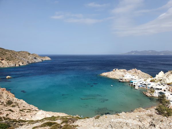
Firopotamos is more settlement than beach: sirmata houses, a church, a shallow bay and steep rock either side. Easy swimming for young children, sea caves worth a mask, and more shelter than most of this coast. There was a canteen here years ago and none on my last visit, but a small beach bar is trading again as of 2026, so treat it as a bonus and still carry food and water. Wind exposure: North coast but partly protected; in a strong meltemi go south. See the Firopotamos beach guide.
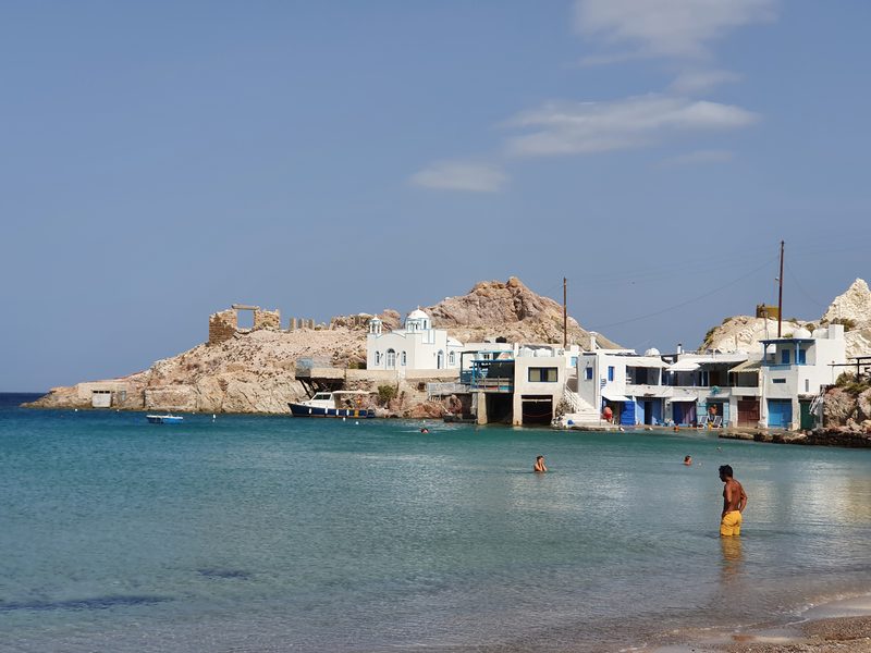
Mandrakia is another asphalt-reached fishing village with white rock formations and two small swimming spots, Tourkothalassa and Gerania, though for many people the fish taverna on the water is the bigger draw. North-facing and wind-sensitive.
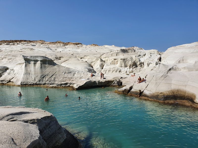
Sarakiniko is the image most people arrive with: hollowed bone-white rock against very dark water, closer to a landscape than a beach. The sand is a scrap at the head of the inlet, so you swim off the rock, and with no shade and severe glare it is worth going early or late, when it is also less busy. A small tanker went onto the rocks here in 2003, and divers still go down to what is left of it. A canteen sometimes runs at the car park in high season, but it comes and goes with demand and staffing, so carry water anyway. Wind exposure: Fully exposed north. In a meltemi it is a viewpoint, not a swim. Read the Sarakiniko guide.
Mytakas is a small sandy bay with clear water and the same wind problem. Agios Konstantinos, further on, is the most convincingly unspoilt fishing hamlet I found on Milos, with good rock for snorkelling; behind a wall of tall white rock beside it, Alogomandra has pale fine sand and no shade. Pahena is wide and sandy with stacks rising out of the water and a view across to the Glaronisia islets.
Kapros and Papafragas are sea caves and rock clefts with slivers of sand inside, used as pirate anchorages in Byzantine times. Kapros is straightforward; Papafragas needs a steep scramble I would not take young children down. The inlets are enclosed enough to collect floating rubbish even in calm weather, and a north wind makes them unswimmable. Details in the Papafragas caves guide.
Pollonia closes the coast: a small port town with a long, wide, shallow beach and a proper choice of tavernas behind it, sheltered enough for families on most days, though a hard meltemi still spoils it. Polychronis, just outside town, usually has a canteen and umbrellas.
What Is on the East Coast?
Start with a warning. Voudia appears on maps as a beach and is a shelf of white rock directly beneath a mining plant. Not somewhere to swim.
South of it, Kastanas, Tria Pigadia and Kolibisionas are east-facing coves on a dirt road that was in good condition when I drove it. Kastanas is the one I liked best, with several tiny pebble bays of coloured stones, clear water and excellent snorkelling. There are no facilities of any kind, it is popular with naturists and spearfishing divers, and almost everyone else out there is local. Wind exposure: East-facing, so the meltemi still reaches it; a southerly leaves it calm. The sun drops behind the hills earlier here than anywhere else, so arrive in the morning. More in the remote beaches of Milos guide.
Thiorichia, at the corner where this coast turns towards the south, is the most interesting place on the shoreline and barely a beach. Sulphur was mined here from the 1890s to the late 1950s, with a self-contained settlement above the shore that had housing, offices, warehouses and its own power supply. Cheaper sulphur abroad closed the mines, and the last resident is recorded as leaving in 1971. What remains is a yellow beach beneath a ruined industrial village you can walk through, carefully, because floors and roofs have gone. Reach it by boat, on foot, or in a 4WD; a normal car or an ATV will not make the descent and your insurance will not cover you if you try. Wind exposure: It faces roughly east to south-east, so it should be partly out of a straight northerly, but this is exposed dirt-road coast and worth judging on the day. Visit the mining museum in Adamas first and the ruins mean far more.
Firlingos, just along from it and reachable only by boat, is a small beach of white and red rock with very clear water and sea caves that reward a mask.
What Are the Best Beaches on the South Coast?
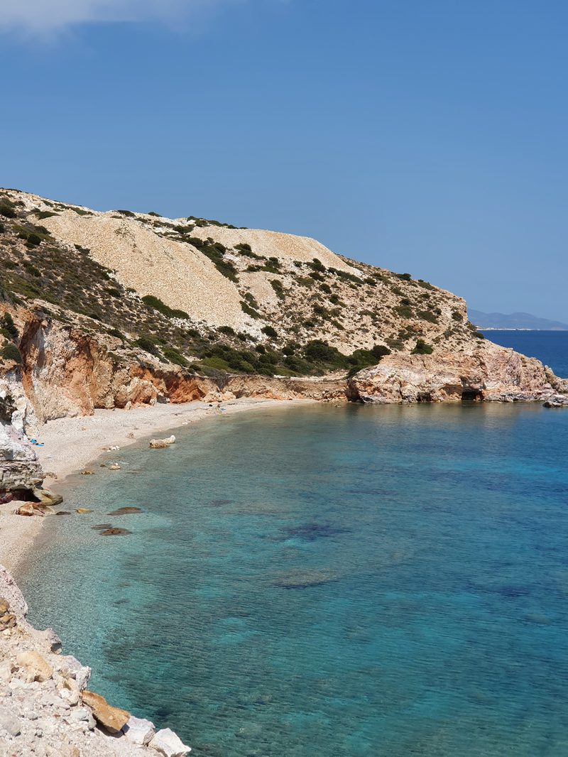
The volcanic side, red and ochre and rust-streaked, and where you drive when the meltemi runs.
Paleochori is one of the longest and best sandy beaches on Milos, with thermally streaked rock behind and very clear water in front. It is easy to reach on a made road, which is why anyone staying more than a few days ends up here, and it has loungers, rooms, watersports and a couple of restaurants, Sirocco among them, still cooking with the volcanic sand heat as of 2026. Walk to the far left end and climb the rocks for space, but take shade with you. Wind exposure: Exposed to southerlies. On a south wind day drive to Firopotamos or Pollonia. Full write-up in the Paleochori beach guide.
Psaravolada, reached on foot or by sea only, is dark pebbles and silence, with common naturism and nothing else.
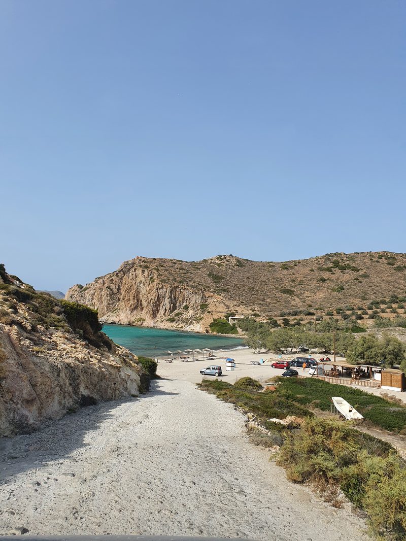
Agia Kyriaki is my favourite conventional beach on the island: sheltered, shallow, sandy, with real trees for shade and tavernas renting sunbeds behind. It has never been crowded on any visit of mine, though July and August will stretch that shade thin, and a traditional wooden boat runs from here to Kleftiko. Walk or swim away from the main sand and you find a few small coves to yourself. Wind exposure: South-facing but well protected; in a hard southerly go north to Mandrakia.
Gerakas, the next bay along and reachable only by sea, is fine white sand and turquoise water, and turns up on most of the sailing tours.
Tsigrado is a narrow cleft in a cliff, reached on an easy dirt road and then a descent finishing with a rope and a short ladder, still the way in as of 2026, though nobody in particular maintains it and its condition varies year to year. Not dangerous so much as committing, and the climb back is harder than the way down; if that is not for you, paddle round from Firiplaka or arrive by boat. I was there on a day of strong southerlies, when the descent looked like a poor idea, and left it alone.
Firiplaka is the south coast at its best: long, sandy, shallow, backed by banded volcanic cliffs, with a beach bar and loungers at one end and quiet sand if you walk right, and the bar is still trading as of 2026. It suits families, and on a settled day you can stay from morning to evening, which is rarer here than you would think. Park at the cliff top and walk down. Wind exposure: South-facing; a southerly closes it, a meltemi leaves it flat. Both this and Tsigrado are covered in the Firiplaka and Tsigrado guide.
Provatas holds the island's blue flag and has a four-star hotel behind it, which by Milos standards feels imported from elsewhere. The sand is fine and the water calm, but it is wall-to-wall paid loungers and I found it the least distinctive beach of its size here. Wind exposure: South-facing, though sheltered by headlands. See the Provatas beach guide.
Just west, Agios Sostis is three small sandy coves with a few rooms and restaurants, and Kipos is a quiet drive-to beach with a restaurant over the water and the 5th-century Panagia Kipou church, which holds a Hellenistic marble sarcophagus. Kipos is the last place on the island to buy water or snacks before you head west, and a departure point for Kleftiko boats.
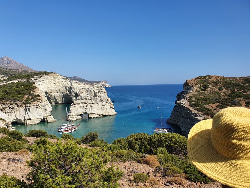
What About the Western Arm and Kleftiko?
West of Kipos the asphalt gives out and the island empties. Most people see this coast from a boat, and for most people that is the right decision. See the Milos boat tours guide. If you would rather drive part of it, the ATV rental guide covers which tracks a quad genuinely handles.
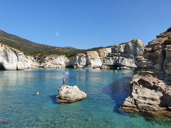
Kleftiko is why the boats run: not a beach but an enclosed bay of tall white sea stacks and arches out of very clear water, and probably the best snorkelling on Milos, since you can swim through the arches and into the caves. Boats leave from Adamas, Kipos and Agia Kyriaki, some for a few hours and some all day. You can also walk in: the trailhead is up on the mountain, a couple of kilometres beyond the monastery of Agios Ioannis Siderianos, and the walk took me 40 to 50 minutes each way at an easy pace, steep in places. Wear closed shoes. Milos has its own red viper, venomous enough to take seriously, and locals will tell you this hillside is where it lives. Wind exposure: Southerlies cloud the water. Boats sail only when the wind allows, and a strong meltemi will cancel them as readily as a southerly. See the Kleftiko guide.
Sikia is a collapsed sea cave with obsidian in the rock and room only for smaller boats to enter. The name means fig tree, after the one growing above the hole in its roof. A hiking path exists and was shut after heavy rainfall when I asked, but it is open again as of 2026, an unmanaged natural-terrain trail with no gate or fee.
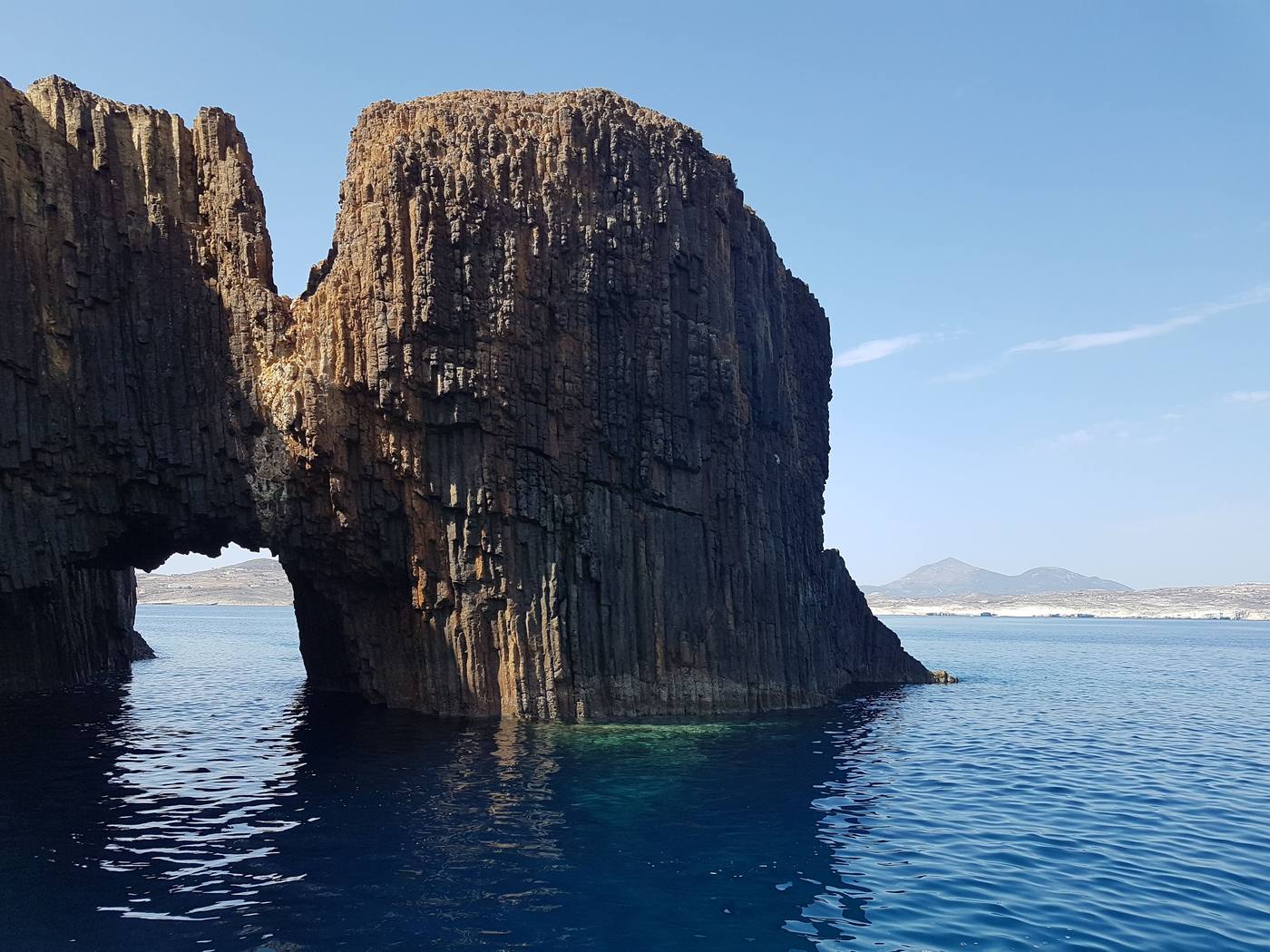
Gerontas and Katergo are the other big-scenery stops, usually done by boat but reachable by road: a bumpy dirt track, then 10 to 15 minutes down a path with a couple of steep sections. My day at Gerontas was a southerly, so the swimming was off and the setting still made it worthwhile.
The rest is for people with a 4WD and no fixed plans. Agios Ioannis is three long secluded beaches below the monastery. Triades and Ammoudaraki have fine sand at the end of a punishing track and are best avoided in a westerly. Agathia is a long empty sweep, easiest by sea, and Vani (an old manganese mining cape) and Agios Dimitrios (a scrap of sand with a white chapel) are boat stops. Embourios is the only inhabited village out west, and the draw is a family taverna rather than the sand; on the way, Rivari is a protected bird lagoon with the wild, half-rock Fatourena beside it.
Milos Beaches by Access, Facilities and Wind
| Beach | Access | Facilities | Wind exposure |
|---|---|---|---|
| Papikinou | Asphalt, walkable | Loungers, shade, watersports | Sheltered inner bay |
| Achivadolimni | Asphalt | None | Faces north into the gulf; sheltered from southerlies |
| Plathiena | Asphalt + walk | Canteen (unreliable) | North, meltemi |
| Firopotamos | Asphalt + descent | None | North, partly sheltered |
| Sarakiniko | Asphalt, car park | Canteen only | North, fully exposed |
| Papafragas | Steep scramble | None | North; collects litter |
| Kastanas | Dirt road | None | East; sun goes early |
| Thiorichia | 4WD, boat or foot | None | East to south-east; judge on the day |
| Paleochori | Asphalt | Loungers, tavernas | South |
| Tsigrado | Dirt road + rope descent | None | South |
| Firiplaka | Dirt road + walk down | Beach bar, loungers | South |
| Agia Kyriaki | Asphalt | Tavernas, sunbeds, trees | South, well protected |
| Gerontas | Rough dirt + short path | None | West and south-west |
| Kleftiko | Boat or steep hike | None | Boats sail only when the wind allows |
Facilities on Milos are seasonal and change year to year. Treat every canteen in this table as a bonus rather than a plan.
What Should You Know Before Going?
- Your vehicle is your beach list. A standard hire car covers the north coast, Paleochori, Firiplaka, Provatas and Agia Kyriaki, which is a good week. Everything west needs a 4WD, a boat or your feet. Never take a small car or a quad down a track it cannot climb back up, because insurance will not cover you. The Milos car rental guide has the detail.
- Bring water, food and shade almost everywhere. The most common mistake on Milos. Buy supplies in Adamas or Pollonia in the morning.
- The glare is worse than the heat. White rock at Sarakiniko and pale sand at Alogomandra throw the sun straight back at you.
- Check wind direction, not just strength. A force 5 meltemi is a perfect south-coast day; the same wind from the south is a north-coast day.
- Book the Kleftiko boat with a spare day in hand. Sailings cancel on wind, and people with one shot at it go home without the photograph.
My habit now is to pick the coast the night before from the wind forecast and the specific beach the next morning. It is the opposite of how most people plan a beach holiday and it works far better here.
Who Are the Milos Beaches For?
Families want the inner bay and the sheltered south: Papikinou, Achivadolimni, Firiplaka, Agia Kyriaki. Anyone chasing landscape over swimming wants Sarakiniko, Thiorichia and a boat to Kleftiko. Snorkellers should aim at Firopotamos and Kastanas. If crowds are what you are escaping, take the dirt roads east or west and come in June or late September. For what else fills the days, see the things to do in Milos guide and the Milos travel guide.
Milos has around 70 named beaches, more than most Greek islands, and roughly 15 worth building a day around. The best beaches in Milos sit on opposite coasts by design: when the meltemi blows from the north, go south to Paleochori, Firiplaka or Agia Kyriaki; when the wind swings south, go north to Firopotamos or Pollonia. Kleftiko is reached by boat or a 40 to 50 minute hike each way, and almost nowhere on the island has shade, water or a reliable canteen.
Planning the rest of your island time? Start with our complete Milos travel guide.
Last updated: 1 August 2026